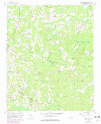
1957 Map of Murchisontown
USGS Topo · Published 1982About this map
Murchisontown and the village of Cameron anchor this mid-century survey of the North Carolina sandhills, where the borders of Lee, Moore, and Harnett Counties converge. The landscape is defined by the Seaboard Coast Line railroad and the Jefferson Davis Highway, which facilitate movement through a region otherwise characterized by dense creek networks and swampy lowlands. Local community life is centered around a remarkably high density of country churches and schools, including McIver Sch, McQueen Chapel, and Garners Chapel.
Find a feature on this map
70 named features on this map. Tap any name to fly to it.
Don’t see what you’re looking for? This feature index may not catch every label — zoom into the map to look around manually.
Map Details
Editions of this 1957 Murchisontown Map
2 editions found
Other maps of this area

1948 · Southern Pines
USGS Topo · 1:62,500

1948 · Clifdale
USGS Topo · 1:62,500

1950 · Lobelia
USGS Topo · 1:24,000

1950 · Niagara
USGS Topo · 1:24,000

1951 · Clifdale
USGS Topo · 1:62,500

1953 · Raleigh
USGS Topo · 1:250,000

1954 · Raleigh
USGS Topo · 1:250,000

1957 · Murchisontown
USGS Topo · 1:24,000

1957 · Southern Pines
USGS Topo · 1:62,500
1957 · Niagara
USGS Topo · 1:24,000