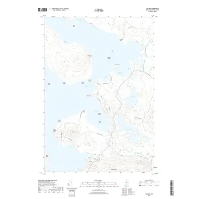
2018 Map of Lily Bay
USGS Topo · Published 2018About this map
Moosehead Lake dominates this coastal and island landscape in Piscataquis County, where the transition from deep water to the peaks of Burnt Jacket Mtn and Scammon Ridge defines the regional geography. This 2018 survey details a complex network of points and coves, including Caribou Point and Doughnut Cove, alongside a dense concentration of islands such as Sugar Island, Twomile Island, and the uniquely named Treasure Island.
Find a feature on this map
61 named features on this map. Tap any name to fly to it.
Don’t see what you’re looking for? This feature index may not catch every label — zoom into the map to look around manually.
Map Details
Editions of this 2018 Lily Bay Map
This is the sole edition of this map. No revisions or reprints were ever made.
Other maps of this area

1920 · Moosehead Lake
USGS Topo · 1:62,500

1922 · Moosehead Lake
USGS Topo · 1:62,500

1930 · Moosehead Lake
USGS Topo · 1:62,500

1944 · Moosehead Lake
USGS Topo · 1:62,500

1950 · Sebec Lake
USGS Topo · 1:62,500

1951 · Greenville
USGS Topo · 1:62,500

1952 · First Roach Pond
USGS Topo · 1:62,500

1954 · Millinocket
USGS Topo · 1:250,000

1957 · Moosehead Lake
USGS Topo · 1:62,500

1958 · Millinocket
USGS Topo · 1:250,000
Featured Places
- Greenville, ME
- Beaver Cove, ME
- Lily Bay Township, ME
- Harfords Point Township, ME
- Bowdoin College Grant West Township, ME