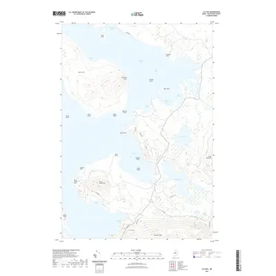
2021 Map of Lily Bay
USGS Topo · Published 2021About this map
Moosehead Lake dominates this landscape, its waters reaching into complex inlets like Lily Bay and Beaver Cove. The eastern shore of the lake is punctuated by a series of significant heights, most notably Burnt Jacket Mtn and Prong Pond Mtn, which rise sharply from the water's edge. The distribution of infrastructure reveals a focus on the southern and eastern shorelines, where residential access roads like Main St, Hilltop Dr, and Bayview Dr suggest a concentration of settlement or recreational dwellings.
Find a feature on this map
43 named features on this map. Tap any name to fly to it.
Don’t see what you’re looking for? This feature index may not catch every label — zoom into the map to look around manually.
Map Details
Editions of this 2021 Lily Bay Map
This is the sole edition of this map. No revisions or reprints were ever made.
Other maps of this area

1920 · Moosehead Lake
USGS Topo · 1:62,500

1922 · Moosehead Lake
USGS Topo · 1:62,500

1930 · Moosehead Lake
USGS Topo · 1:62,500

1944 · Moosehead Lake
USGS Topo · 1:62,500

1950 · Sebec Lake
USGS Topo · 1:62,500

1951 · Greenville
USGS Topo · 1:62,500

1952 · First Roach Pond
USGS Topo · 1:62,500

1954 · Millinocket
USGS Topo · 1:250,000

1957 · Moosehead Lake
USGS Topo · 1:62,500

1958 · Millinocket
USGS Topo · 1:250,000
Featured Places
- Greenville, ME
- Beaver Cove, ME
- Lily Bay Township, ME
- Harfords Point Township, ME
- Bowdoin College Grant West Township, ME