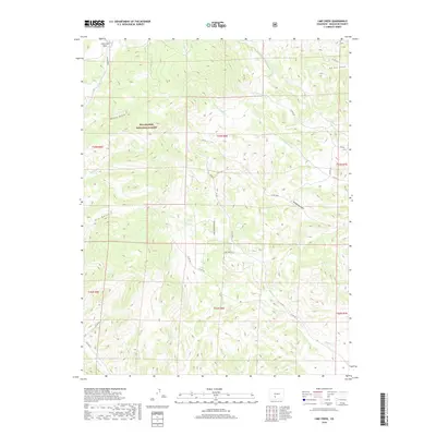
2019 Map of Lime Creek
USGS Topo · Published 2019About this map
Rio Grande National Forest dominates the high-altitude landscape of this 2019 survey, where the drainages of the San Luis Valley begin their descent. The map captures a rugged network of watercourses including N Fork Carnero Cr and San Juan Cr, defining the complex topography of Saguache County. Land use is characterized by traditional ranching and forestry access, represented by a sparse grid of forest and county roads such as Lime Creek Rd and Co RD 42k. Distinctive geographic markers like Fullerton Park and the sharp descent of Red Rock Canyon provide clear reference points for the transition from timbered slopes to the arid gulches below. Notable terrain features including Poison Gulch and Sanderson Gulch illustrate the seasonal hydrology of the region, while newer developments like Lime Creek Estate Rd suggest modern residential expansion into the mountainous terrain.
Find a feature on this map
35 named features on this map. Tap any name to fly to it.
Don’t see what you’re looking for? This feature index may not catch every label — zoom into the map to look around manually.
Map Details
Editions of this 2019 Lime Creek Map
This is the sole edition of this map. No revisions or reprints were ever made.
Other maps of this area

1915 · Del Norte
USGS Topo · 1:125,000

1917 · Del Norte
USGS Topo · 1:125,000

1945 · Durango
USGS Topo · 1:250,000

1953 · Durango
USGS Topo · 1:250,000

1954 · Durango
USGS Topo · 1:250,000

1956 · Montrose
USGS Topo · 1:250,000

1959 · Montrose
USGS Topo · 1:250,000

1960 · Montrose
USGS Topo · 1:250,000

1961 · Durango
USGS Topo · 1:250,000

1963 · Durango
USGS Topo · 1:250,000