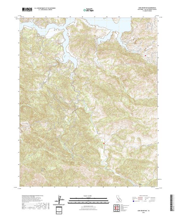
2021 Map of Lime Mountain
USGS Topo · Published 2021About this map
Lake Nacimiento dominates the northern landscape of this San Luis Obispo County survey, its jagged shoreline reaching into canyons carved by Town Cr and Snake Cr. The terrain rises sharply toward the south and west, where the rugged peaks of the Santa Lucia Range and the distinctive summit of Lime Mtn define the horizon. This region is characterized by steep ridges and narrow creek beds, including Franklin Cr and Dip Cr, which drain into the larger Las Tablas Cr system.
Find a feature on this map
62 named features on this map. Tap any name to fly to it.
Don’t see what you’re looking for? This feature index may not catch every label — zoom into the map to look around manually.
Map Details
Editions of this 2021 Lime Mountain Map
This is the sole edition of this map. No revisions or reprints were ever made.
Other maps of this area

1919 · Bryson
USGS Topo · 1:62,500

1919 · Bradley
USGS Topo · 1:62,500

1919 · Adelaida
USGS Topo · 1:62,500

1919 · San Simeon
USGS Topo · 1:62,500

1932 · Adelaida
USGS Topo · 1:62,500

1937 · San Simeon
USGS Topo · 1:62,500

1941 · Bradley
USGS Topo · 1:62,500

1941 · Bryson
USGS Topo · 1:62,500

1942 · Adelaida
USGS Topo · 1:62,500

1942 · Bryson
USGS Topo · 1:62,500