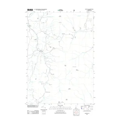
2012 Map of Lincoln
USGS Topo · Published 2012About this map
Lincoln and South Lincoln anchor this high-elevation landscape in the Green Mountains, where the terrain is defined by a north-south ridgeline including Mount Abraham, Mount Roosevelt, and Bread Loaf Mountain. The settlement pattern follows the narrow valley of the New Haven River and its numerous tributaries like Beaver Meadow Brook and Cota Brook. Local genealogy is well-represented by family and community burial grounds, including the Lee Cem, Pope Cem, and the uniquely named Eubar Odette Cem near Prospect Rock. A notable cultural feature is The Natural Turnpike, which winds through the southern portion of the quadrangle near Cobb Hill. This 2012 data shows the modern persistence of historic mountain passes like Lincoln Gap and the network of shelters along the ridge, such as Battell Shelter and Emily Proctor Shelter, which serve the long-distance trail system through the National Forest.
Find a feature on this map
58 named features on this map. Tap any name to fly to it.
Don’t see what you’re looking for? This feature index may not catch every label — zoom into the map to look around manually.
Map Details
Editions of this 2012 Lincoln Map
This is the sole edition of this map. No revisions or reprints were ever made.
Other maps of this area

1902 · Brandon
USGS Topo · 1:62,500

1903 · Middlebury
USGS Topo · 1:62,500

1904 · Brandon
USGS Topo · 1:62,500

1905 · Middlebury
USGS Topo · 1:62,500

1915 · Rochester
USGS Topo · 1:62,500

1917 · Rochester
USGS Topo · 1:62,500

1919 · Lincoln Mountain
USGS Topo · 1:62,500

1920 · Lincoln Mountain
USGS Topo · 1:48,000

1920 · Brandon
USGS Topo · 1:62,500

1920 · Middlebury
USGS Topo · 1:62,500