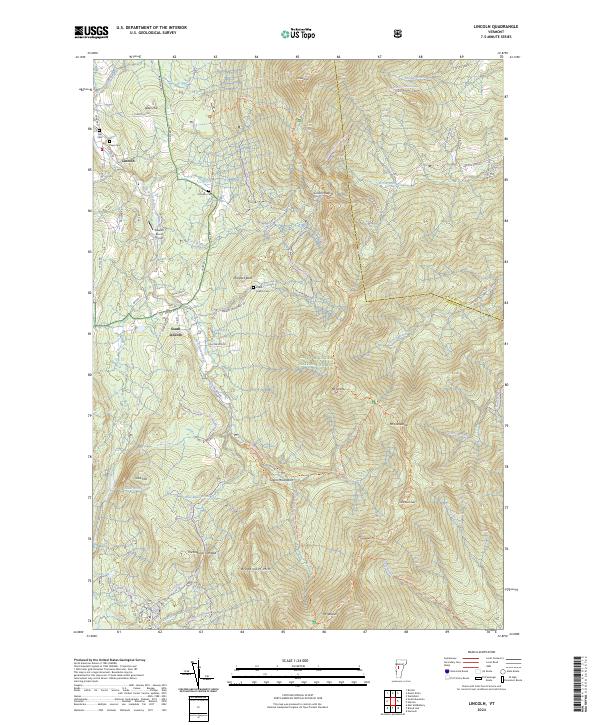
2024 Map of Lincoln
USGS Topo · Published 2024About this map
Lincoln and South Lincoln anchor the western slopes of the Green Mountains, where the New Haven River and its numerous tributaries like Lincoln Brook and Alder Brook carve through the high terrain of Addison Co. This contemporary documentation of the landscape reveals a region defined by its verticality, rising from the valley floor to prominent summits including Mt Abraham, Mt Grant, and Mt Wilson. Significant acreage is dedicated to the Green Mountain National Forest and the Breadloaf Wilderness, emphasizing the region's character as a protected natural corridor. For those tracing local history, several family burial grounds such as Lee Cem, Pope Cem, and the Eubar Odette Cem remain preserved along the winding mountain roads. The presence of Maules Roost Airport and historic routes like The Natural Turnpike illustrate how transportation has adapted to the challenging geography of the Green Mountains.
Find a feature on this map
67 named features on this map. Tap any name to fly to it.
Don’t see what you’re looking for? This feature index may not catch every label — zoom into the map to look around manually.
Map Details
Editions of this 2024 Lincoln Map
This is the sole edition of this map. No revisions or reprints were ever made.
Other maps of this area

1902 · Brandon
USGS Topo · 1:62,500

1903 · Middlebury
USGS Topo · 1:62,500

1904 · Brandon
USGS Topo · 1:62,500

1905 · Middlebury
USGS Topo · 1:62,500

1915 · Rochester
USGS Topo · 1:62,500

1917 · Rochester
USGS Topo · 1:62,500

1919 · Lincoln Mountain
USGS Topo · 1:62,500

1920 · Lincoln Mountain
USGS Topo · 1:48,000

1920 · Brandon
USGS Topo · 1:62,500

1920 · Middlebury
USGS Topo · 1:62,500