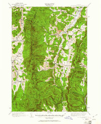
1919 Map of Lincoln Mountain
USGS Topo · Published 1961About this map
The Green Mountains define the spine of this early 20th-century landscape, where rugged peaks and deep gaps dictated the patterns of Vermont hill country settlement. High-altitude landmarks like Battell Lodge and Proctor Lodge sit near the crests of Mt Abraham and Mt Ellen, while the Mad River valley serves as the primary corridor for towns like Warren and Waitsfield. The distribution of nearly twenty numbered district schools, such as the Alder Hill School and South Hill School, illustrates the once-dense network of small rural communities that operated before modern consolidation.
Find a feature on this map
108 named features on this map. Tap any name to fly to it.
Don’t see what you’re looking for? This feature index may not catch every label — zoom into the map to look around manually.
Map Details
Editions of this 1919 Lincoln Mountain Map
2 editions found
Other maps of this area

1902 · Brandon
USGS Topo · 1:62,500

1903 · Middlebury
USGS Topo · 1:62,500

1904 · Brandon
USGS Topo · 1:62,500

1905 · Middlebury
USGS Topo · 1:62,500

1906 · Burlington
USGS Topo · 1:62,500

1915 · Rochester
USGS Topo · 1:62,500

1917 · Rochester
USGS Topo · 1:62,500

1919 · Royalton
USGS Topo · 1:62,500

1919 · Burlington
USGS Topo · 1:62,500

1919 · Lincoln Mountain
USGS Topo · 1:62,500