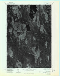
1975 Map of Lincoln NW
USGS Topo · Published 1980About this map
Mattamiscontis Lake and its smaller counterpart, Little Mattamiscontis Lake, anchor this orthophotoquad, which reveals the dense timberlands of central Maine in the mid-1970s. The aerial perspective captures a landscape defined by water and wood, where the rugged slopes of Mattamiscontis Mountain rise above the drainage basins of the Mattamiscontis Stream and Seboeis Stream. This imagery-based survey provides a raw view of the working forest, showing the intricate patterns of logging roads and clearings that bypass the deeper waters of South Branch Lake to the south. Unlike traditional line maps, this orthophotograph documents the actual texture of the forest floor and shoreline vegetation, offering researchers a literal record of the wilderness and land management as it existed before decades of subsequent growth and development.
Find a feature on this map
6 named features on this map. Tap any name to fly to it.
Don’t see what you’re looking for? This feature index may not catch every label — zoom into the map to look around manually.
Map Details
Editions of this 1975 Lincoln NW Map
This is the sole edition of this map. No revisions or reprints were ever made.
Other maps of this area

1942 · Lincoln
USGS Topo · 1:62,500

1947 · Schoodic
USGS Topo · 1:62,500

1949 · Schoodic
USGS Topo · 1:62,500

1951 · Norcross
USGS Topo · 1:62,500

1951 · Millinocket
USGS Topo · 1:62,500

1954 · Millinocket
USGS Topo · 1:250,000

1957 · Lincoln
USGS Topo · 1:62,500

1958 · Millinocket
USGS Topo · 1:250,000

1960 · Millinocket
USGS Topo · 1:250,000

1975 · Millinocket SW
USGS Topo · 1:24,000