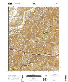
2019 Map of Linden
USGS Topo · Published 2019About this map
Shenandoah Farms and the winding Shenandoah River define the northern reaches of this landscape where Clarke, Warren, and Fauquier counties meet. The terrain is marked by significant topographical shifts, from the riverbanks at Morgans Ford Bridge to the high ridges of Blue Mountain. A major corridor for travel and recreation, the Appalachian National Scenic Trail traverses the eastern heights, overlooking deep hollows like Wildcat Hollow and Stillhouse Hollow.
Find a feature on this map
31 named features on this map. Tap any name to fly to it.
Don’t see what you’re looking for? This feature index may not catch every label — zoom into the map to look around manually.
Map Details
Editions of this 2019 Linden Map
This is the sole edition of this map. No revisions or reprints were ever made.
Other maps of this area

1884 · Harpers Ferry
USGS Topo · 1:125,000

1891 · Harpers Ferry
USGS Topo · 1:125,000

1893 · Luray
USGS Topo · 1:125,000

1893 · Harpers Ferry
USGS Topo · 1:125,000

1894 · Warrenton
USGS Topo · 1:125,000

1894 · Winchester
USGS Topo · 1:125,000

1905 · Luray
USGS Topo · 1:125,000

1916 · Berryville
USGS Topo · 1:62,500

1938 · Winchester
USGS Topo · 1:48,000

1939 · Front Royal
USGS Topo · 1:48,000