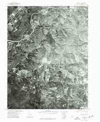
1972 Map of Linden
USGS Topo · Published 1977About this map
The Shenandoah River snakes through the northern portion of this 1970s orthophotograph, providing a stark visual record of the Virginia landscape as it appeared in early spring. This unique aerial perspective, captured by the U.S. Geological Survey in cooperation with the Commonwealth of Virginia, offers a different level of detail than traditional topographic drawings, emphasizing land use, vegetation density, and the winding road networks of the Blue Ridge foothills. The settlement of Linden sits prominently near the center, while Markham is visible to the east. By studying the contrast between the dark wooded ridges and the lighter, cleared agricultural patches, researchers can trace the footprint of rural development during this era, noting the precise alignment of transportation corridors and the layout of individual properties along the river valley.
Find a feature on this map
3 named features on this map. Tap any name to fly to it.
Don’t see what you’re looking for? This feature index may not catch every label — zoom into the map to look around manually.
Map Details
Editions of this 1972 Linden Map
This is the sole edition of this map. No revisions or reprints were ever made.
Other maps of this area

1884 · Harpers Ferry
USGS Topo · 1:125,000

1891 · Harpers Ferry
USGS Topo · 1:125,000

1893 · Luray
USGS Topo · 1:125,000

1893 · Harpers Ferry
USGS Topo · 1:125,000

1894 · Warrenton
USGS Topo · 1:125,000

1894 · Winchester
USGS Topo · 1:125,000

1905 · Luray
USGS Topo · 1:125,000

1916 · Berryville
USGS Topo · 1:62,500

1938 · Winchester
USGS Topo · 1:48,000

1939 · Front Royal
USGS Topo · 1:48,000