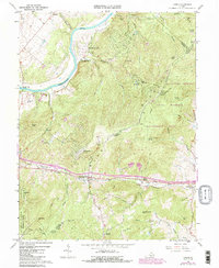
1986 Map of Linden
USGS Topo · Published 1987About this map
The Shenandoah River carves through the northwestern corner of this territory, where the Southern railway and interstate transit pass through the strategic Manassas Gap. The landscape is defined by the high ridges of the Blue Ridge, including High Knob and Hardscrabble Mtn, which separate the river valley from the rolling foothills of Fauquier County. Settlement patterns follow the low passes and river bends, with established communities like Linden, Belle Meade, and Markham serving as focal points along the rail corridor.
Find a feature on this map
51 named features on this map. Tap any name to fly to it.
Don’t see what you’re looking for? This feature index may not catch every label — zoom into the map to look around manually.
Map Details
Editions of this 1986 Linden Map
This is the sole edition of this map. No revisions or reprints were ever made.
Other maps of this area

1884 · Harpers Ferry
USGS Topo · 1:125,000

1891 · Harpers Ferry
USGS Topo · 1:125,000

1893 · Luray
USGS Topo · 1:125,000

1893 · Harpers Ferry
USGS Topo · 1:125,000

1894 · Warrenton
USGS Topo · 1:125,000

1894 · Winchester
USGS Topo · 1:125,000

1905 · Luray
USGS Topo · 1:125,000

1916 · Berryville
USGS Topo · 1:62,500

1938 · Winchester
USGS Topo · 1:48,000

1939 · Front Royal
USGS Topo · 1:48,000