2021 Map of Lindsay
USGS Topo · Published 2021About this map
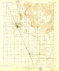
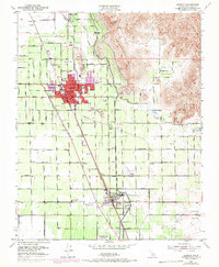
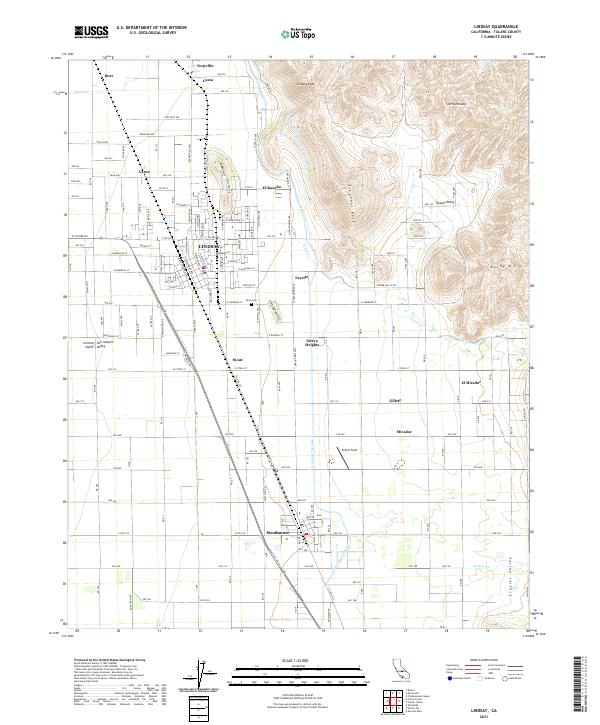
The agricultural grid of the Central Valley meets the rising foothills of the Sierra Nevada in this contemporary survey of southeastern Tulare County. The city of Lindsay serves as the primary hub, surrounded by a constellation of smaller settlements including Strathmore, Tonyville, Lucca, and Sierra Heights. This landscape is defined by the sophisticated water management systems required for the region's orchards and fields, notably the Friant-Kern Canal and the Lindsay Strathmore Irrigation Ditch which trace the contours between the flatlands and the heights of Lindsay Peak and Elephant Back.
Find a feature on this map
160 named features on this map. Tap any name to fly to it.
Don’t see what you’re looking for? This feature index may not catch every label — zoom into the map to look around manually.
Map Details
Editions of this 2021 Lindsay Map
This is the sole edition of this map. No revisions or reprints were ever made.