1928 Map of Lindsay
USGS Topo · Published 1928About this map
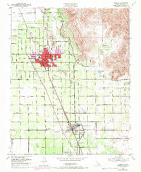
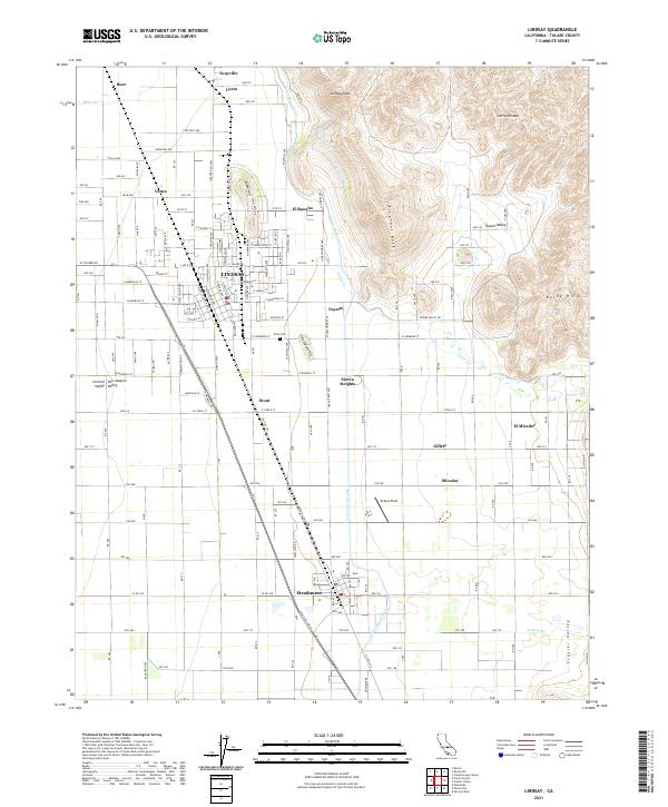
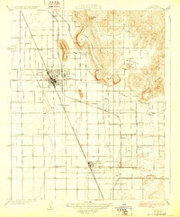
The Rocky Hills and Lindsay Peak Hill rise sharply above the San Joaquin Valley floor, defining the eastern edge of a landscape transitioning into intensive agriculture during the late 1920s. The town of Lindsay serves as a central hub, where the Southern Pacific and Visalia Electric rail lines intersect, facilitating the movement of citrus and other produce. Irrigation infrastructure like the Elephant Back Ditch and the Lewis Creek drainage are vital to the surrounding groves and smaller settlements such as Sierra Heights, El Mirador, and Strathmore. Along the southern border, the Atchison Topeka and Santa Fe railroad cuts across the plain near Abilene and Portex. Rural education centers like Sunnyside School and Lewis Creek School anchor these farming communities, while family-named locales like Hawkins and Reynolds mark the foothills.
Find a feature on this map
31 named features on this map. Tap any name to fly to it.
Don’t see what you’re looking for? This feature index may not catch every label — zoom into the map to look around manually.
Map Details
Editions of this 1928 Lindsay Map
This is the sole edition of this map. No revisions or reprints were ever made.
Historical Maps of Lindsay Through Time
6 maps found