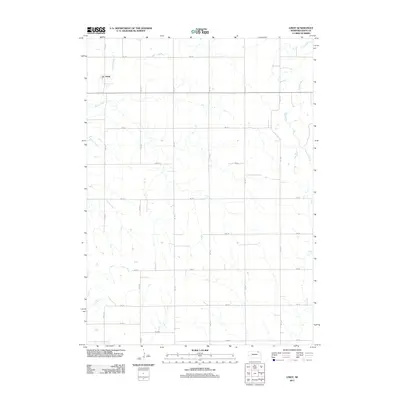
2011 Map of Lindy
USGS Topo · Published 2011About this map
The settlement of Lindy serves as the primary focal point of this Knox County landscape, situated in the northwestern corner of the quadrangle. The terrain is defined by a dense network of sectional roads and avenues, such as 891 Rd and 544 Ave, illustrating the enduring grid pattern of rural Nebraska. This 2011 survey captures the area's hydrology through the winding paths of Hoboe Creek in the west and Weigand Creek in the east, which carve through the agricultural uplands. The road naming convention, including the transition to 883 Way in the south, reflects modern rural addressing systems while preserving the footprint of historic farm-to-market routes. The map provides a clear record of land use and drainage patterns in this corner of the state during the early twenty-first century.
Find a feature on this map
18 named features on this map. Tap any name to fly to it.
Don’t see what you’re looking for? This feature index may not catch every label — zoom into the map to look around manually.
Map Details
Editions of this 2011 Lindy Map
This is the sole edition of this map. No revisions or reprints were ever made.
Other maps of this area

1955 · Sioux City
USGS Topo · 1:250,000

1958 · Sioux City
USGS Topo · 1:250,000

1959 · Sioux City
USGS Topo · 1:250,000

1968 · Tabor SE
USGS Topo · 1:24,000

1968 · Bloomfield NE
USGS Topo · 1:24,000

1968 · Bloomfield SE
USGS Topo · 1:24,000

1974 · Lindy
USGS Topo · 1:24,000

1974 · Bloomfield
USGS Topo · 1:24,000
1974 · Center East
USGS Topo · 1:24,000

1974 · Howe Creek
USGS Topo · 1:24,000