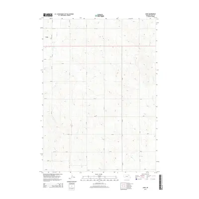
2014 Map of Lindy
USGS Topo · Published 2014About this map
Lindy serves as the primary point of settlement on this Knox County landscape, situated near the western edge of the quadrangle. The terrain is defined by a dense network of sectional roads and the carved paths of local waterways, including Hoboe Cr in the northwest and Weigand Cr to the east. This 2014 survey documents the highly organized grid system typical of the Great Plains, where numbered routes like 891 Rd and 541 Ave divide the land into neat agricultural and residential blocks. The contour lines reveal a rolling topography that breaks the geometric precision of the road network, particularly where it drops into the drainage basins of the local creeks.
Find a feature on this map
19 named features on this map. Tap any name to fly to it.
Don’t see what you’re looking for? This feature index may not catch every label — zoom into the map to look around manually.
Map Details
Editions of this 2014 Lindy Map
This is the sole edition of this map. No revisions or reprints were ever made.
Other maps of this area

1955 · Sioux City
USGS Topo · 1:250,000

1958 · Sioux City
USGS Topo · 1:250,000

1959 · Sioux City
USGS Topo · 1:250,000

1968 · Tabor SE
USGS Topo · 1:24,000

1968 · Bloomfield NE
USGS Topo · 1:24,000

1968 · Bloomfield SE
USGS Topo · 1:24,000

1974 · Lindy
USGS Topo · 1:24,000

1974 · Bloomfield
USGS Topo · 1:24,000
1974 · Center East
USGS Topo · 1:24,000

1974 · Howe Creek
USGS Topo · 1:24,000