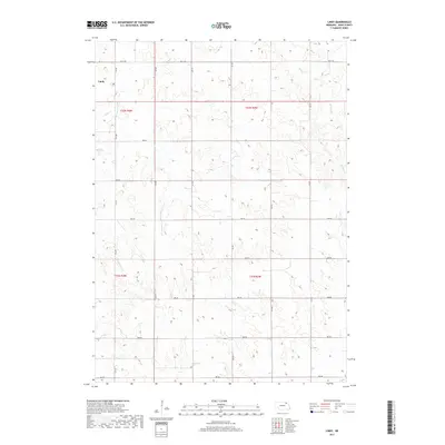
2017 Map of Lindy
USGS Topo · Published 2017About this map
Lindy serves as the primary focal point of this northeastern Nebraska landscape, situated near the headwaters of Hoboe Cr. This 2017 survey by the U.S. Geological Survey reveals a region defined by its highly dissected terrain and a systematic grid of section-line roads. The drainage pattern is dominated by narrow valleys and ridges, with Weigand Cr cutting through the eastern portion of the quadrangle. The infrastructure reflects a rural agricultural economy, where long-established range and township lines like t32n r4w and t31n r3w organize the territory. Local travel relies on a network of gravel and dirt routes such as 891st Rd and 538 Ave, which navigate the elevation changes between the creek beds and the high plains.
Find a feature on this map
22 named features on this map. Tap any name to fly to it.
Don’t see what you’re looking for? This feature index may not catch every label — zoom into the map to look around manually.
Map Details
Editions of this 2017 Lindy Map
This is the sole edition of this map. No revisions or reprints were ever made.
Other maps of this area

1955 · Sioux City
USGS Topo · 1:250,000

1958 · Sioux City
USGS Topo · 1:250,000

1959 · Sioux City
USGS Topo · 1:250,000

1968 · Tabor SE
USGS Topo · 1:24,000

1968 · Bloomfield NE
USGS Topo · 1:24,000

1968 · Bloomfield SE
USGS Topo · 1:24,000

1974 · Lindy
USGS Topo · 1:24,000

1974 · Bloomfield
USGS Topo · 1:24,000
1974 · Center East
USGS Topo · 1:24,000

1974 · Howe Creek
USGS Topo · 1:24,000