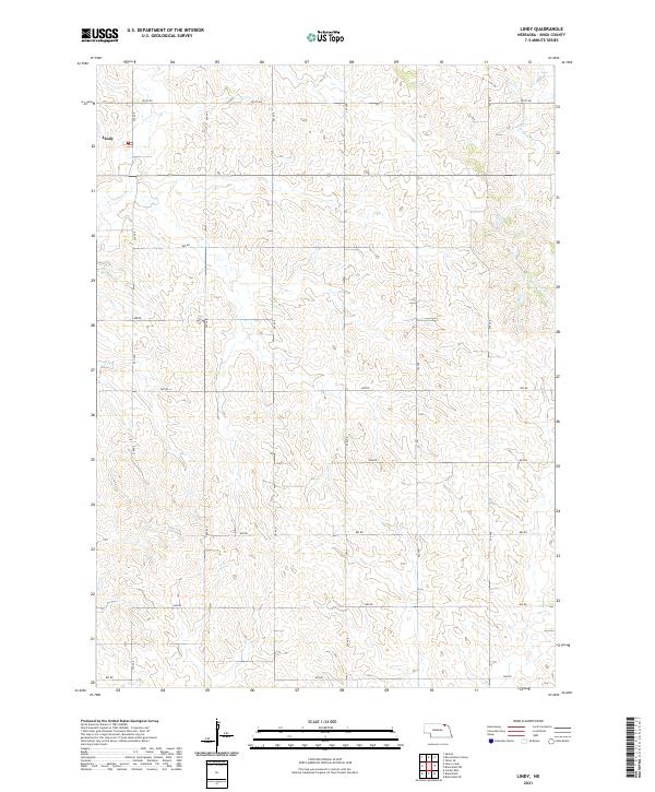
2021 Map of Lindy
USGS Topo · Published 2021About this map
Lindy serves as the primary point of settlement in this northern Knox County landscape, situated near the western edge of the quadrangle. The terrain is defined by the drainage patterns of Hoboe Cr and Weigand Cr, which cut through the undulating Nebraska hills. A rigid grid of section lines and county roads, such as 891st Rd and 542 Ave, provides the framework for this agricultural region, reflecting the systematic land survey of the American Midwest. The transition from the higher elevations down to the creek beds illustrates the typical topography of the Missouri River upland, where farmsteads and rural routes follow the contours of the land.
Find a feature on this map
22 named features on this map. Tap any name to fly to it.
Don’t see what you’re looking for? This feature index may not catch every label — zoom into the map to look around manually.
Map Details
Editions of this 2021 Lindy Map
This is the sole edition of this map. No revisions or reprints were ever made.
Other maps of this area

1955 · Sioux City
USGS Topo · 1:250,000

1958 · Sioux City
USGS Topo · 1:250,000

1959 · Sioux City
USGS Topo · 1:250,000

1968 · Tabor SE
USGS Topo · 1:24,000

1968 · Bloomfield NE
USGS Topo · 1:24,000

1968 · Bloomfield SE
USGS Topo · 1:24,000

1974 · Lindy
USGS Topo · 1:24,000

1974 · Bloomfield
USGS Topo · 1:24,000
1974 · Center East
USGS Topo · 1:24,000

1974 · Howe Creek
USGS Topo · 1:24,000