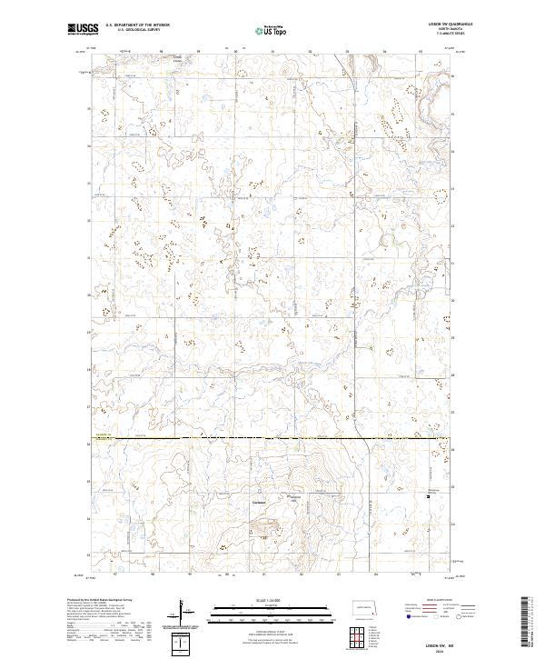
2024 Map of Lisbon SW
USGS Topo · Published 2024About this map
Gwinner sits at the southern edge of this landscape, positioned where the rising terrain of the Whitestone Hills meets the expansive prairie. This 2024 survey documents a region defined by intricate hydrology, where Dead Colt Creek and Timber Coulee weave through a network of small wetlands and depressions characteristic of the North Dakota plains. The boundary between Ransom and Sargent counties divides the map, highlighting the local importance of Gwinner as a regional hub. Genealogists will find the Whitestone Hill Cem near the southern border, a critical landmark for local family history research. The map also traces the modern section-line road network, including Co Rd 8, which structures the movement of people and agricultural goods across this rural landscape.
Find a feature on this map
29 named features on this map. Tap any name to fly to it.
Don’t see what you’re looking for? This feature index may not catch every label — zoom into the map to look around manually.
Map Details
Editions of this 2024 Lisbon SW Map
This is the sole edition of this map. No revisions or reprints were ever made.
Other maps of this area

1953 · Fargo
USGS Topo · 1:250,000

1956 · Fargo
USGS Topo · 1:250,000

1957 · Stirum
USGS Topo · 1:24,000

1957 · Elliott SE
USGS Topo · 1:24,000

1960 · Lisbon SE
USGS Topo · 1:24,000

1960 · Lisbon NE
USGS Topo · 1:24,000

1962 · Lisbon
USGS Topo · 1:24,000
1962 · Hoving
USGS Topo · 1:24,000

1962 · Lisbon SW
USGS Topo · 1:24,000

1962 · Elliott
USGS Topo · 1:24,000