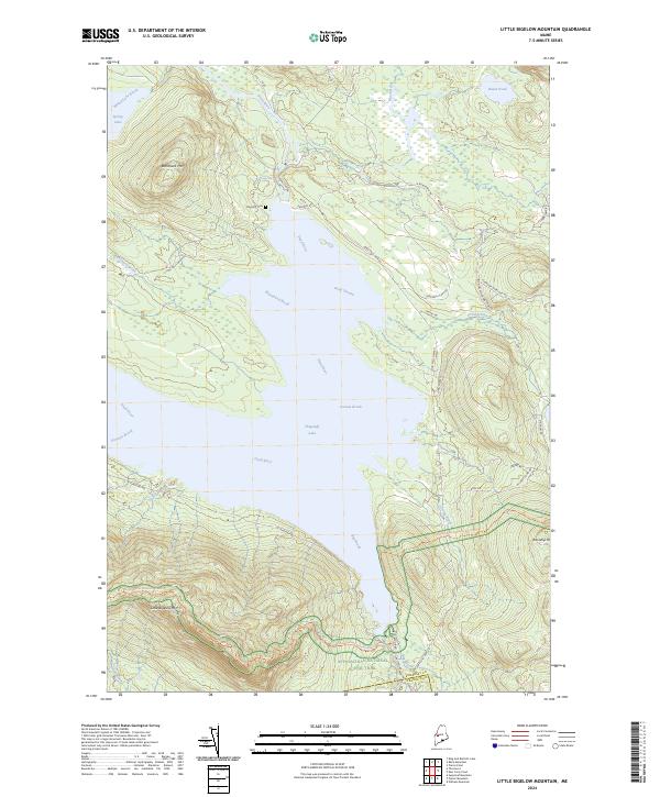
2024 Map of Little Bigelow Mountain
USGS Topo · Published 2024About this map
Flagstaff Lake dominates the central landscape of this Somerset County region, its expansive waters fed by the Dead River and numerous mountain streams. The terrain is defined by the significant elevations of Little Bigelow Mtn and Blanchard Mtn, which provide a dramatic backdrop to the valley floor. The Appalachian National Scenic Trl traverses the southern ridges, passing near Safford Brook and Bog Brook. Historical remnants of the area's development are preserved at the Flagstaff Cem, located near the northern shore. The network of forest roads, including Long Falls Dam Rd and Carrying Place Rd, traces the movement of timber and outdoor enthusiasts through this corner of the Maine woods, connecting remote points like Spring Lake and Basin Pond to the broader geography of the Dead River watershed.
Find a feature on this map
37 named features on this map. Tap any name to fly to it.
Don’t see what you’re looking for? This feature index may not catch every label — zoom into the map to look around manually.
Map Details
Editions of this 2024 Little Bigelow Mountain Map
This is the sole edition of this map. No revisions or reprints were ever made.
Other maps of this area

1925 · Pierce Pond
USGS Topo · 1:48,000

1927 · Pierce Pond
USGS Topo · 1:62,500

1928 · Spencer
USGS Topo · 1:48,000

1928 · Dead River
USGS Topo · 1:62,500

1928 · Stratton
USGS Topo · 1:48,000

1931 · Dead River
USGS Topo · 1:48,000

1932 · Stratton
USGS Topo · 1:62,500

1932 · Spencer
USGS Topo · 1:62,500

1944 · Dead River
USGS Topo · 1:62,500

1944 · Pierce Pond
USGS Topo · 1:62,500
Featured Places
- Carrabassett Valley, ME
- Highland Plantation, ME
- Carrying Place Town Township, ME
- Dead River Township, ME
- Pierce Pond Township, ME