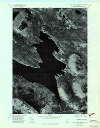
1977 Map of Little Bigelow Mountain
USGS Topo · Published 1983About this map
Flagstaff Lake dominates this late-1970s orthophotoquad, showing the intricate shoreline and deep waters that submerged earlier valley settlements. To the south, the massive ridges of Little Bigelow Mountain rise sharply above the water, while Black Mountain anchors the northwestern terrain. This photographic survey reveals the stark contrast between the vast artificial reservoir and the dense forest cover of the surrounding Somerset County highlands. The Dead River is visible snaking through the northern reaches of the quadrangle before joining the main lake body. Farther east, the secluded West Carry Pond remains tucked within the timberlands, connected by the drainage of Bog Brook. This document provides a raw aerial perspective of the landscape's transformation following mid-century hydroelectric developments.
Find a feature on this map
6 named features on this map. Tap any name to fly to it.
Don’t see what you’re looking for? This feature index may not catch every label — zoom into the map to look around manually.
Map Details
Editions of this 1977 Little Bigelow Mountain Map
This is the sole edition of this map. No revisions or reprints were ever made.
Other maps of this area

1925 · Pierce Pond
USGS Topo · 1:48,000

1927 · Pierce Pond
USGS Topo · 1:62,500

1928 · Spencer
USGS Topo · 1:48,000

1928 · Dead River
USGS Topo · 1:62,500

1928 · Stratton
USGS Topo · 1:48,000

1931 · Dead River
USGS Topo · 1:48,000

1932 · Stratton
USGS Topo · 1:62,500

1932 · Spencer
USGS Topo · 1:62,500

1944 · Dead River
USGS Topo · 1:62,500

1944 · Pierce Pond
USGS Topo · 1:62,500
Featured Places
- Carrabassett Valley, ME
- Highland Plantation, ME
- Dead River Township, ME
- Spring Lake Township, ME
- Carrying Place Town Township, ME