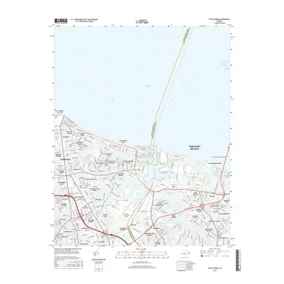
2016 Map of Little Creek
USGS Topo · Published 2016About this map
Chesapeake Bay dominates the northern horizon of this coastal survey, where the massive engineering of the Chesapeake Bay Bridge-Tunnel transitions from land to sea. The landscape is a complex mosaic of dense residential neighborhoods and maritime infrastructure, with the municipal boundary between the City of Norfolk and the City of Virginia Beach bisecting the terrain. Strategic water bodies like Lake Whitehurst, Lake Smith, and the Little Creek Reservoir provide a buffered interior against the urban sprawl of communities like Ocean View and Norvella Heights.
Find a feature on this map
82 named features on this map. Tap any name to fly to it.
Don’t see what you’re looking for? This feature index may not catch every label — zoom into the map to look around manually.
Map Details
Editions of this 2016 Little Creek Map
This is the sole edition of this map. No revisions or reprints were ever made.
Other maps of this area

1907 · Norfolk
USGS Topo · 1:125,000

1907 · Hampton
USGS Topo · 1:62,500

1918 · Cape Henry
USGS Topo · 1:62,500

1919 · Cape Henry
USGS Topo · 1:62,500

1921 · Newport News
USGS Topo · 1:62,500

1943 · Richmond
USGS Topo · 1:250,000

1944 · Hampton
USGS Topo · 1:24,000

1944 · Norfolk South
USGS Topo · 1:25,000

1948 · Norfolk South
USGS Topo · 1:24,000

1948 · Ocean View
USGS Topo · 1:24,000