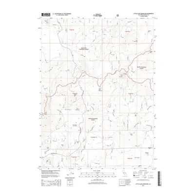
2015 Map of Little Glass Mountain
USGS Topo · Published 2015About this map
Klamath National Forest, Shasta National Forest, and Modoc National Forest converge in this high-elevation volcanic landscape of Siskiyou County. The area is defined by massive obsidian and lava formations, most notably the Little Glass Mountain and the expansive Crater Glass Flow to the northeast. Geologic activity is recorded in the varied craters and vents that dot the terrain, from Paint Pot Crater to the massive Giant Crater in the south. An old Railroad Grade cuts through the northern timberline, hinting at the region's logging history within the heavy forest cover. Human markers are sparse but significant, including the site of Old Camp One and water sources like Harris Spr, which were essential for early forest navigation and industry. The map captures a complex topography of cinder cones and lava flows, including the Tilted Rock Lava Flow, providing a detailed view of these unique volcanic features.
Find a feature on this map
69 named features on this map. Tap any name to fly to it.
Don’t see what you’re looking for? This feature index may not catch every label — zoom into the map to look around manually.
Map Details
Editions of this 2015 Little Glass Mountain Map
This is the sole edition of this map. No revisions or reprints were ever made.
Other maps of this area

1886 · Modoc Lava Bed
USGS Topo · 1:250,000

1892 · Modoc Lava-Bed
USGS Topo · 1:250,000

1932 · Bartle
USGS Topo · 1:96,000

1939 · Bartle
USGS Topo · 1:125,000

1950 · Bray
USGS Topo · 1:62,500

1952 · Medicine Lake
USGS Topo · 1:62,500

1954 · Alturas
USGS Topo · 1:250,000

1958 · Alturas
USGS Topo · 1:250,000

1961 · Hambone
USGS Topo · 1:62,500

1961 · Bartle
USGS Topo · 1:62,500