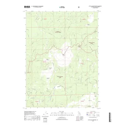
2018 Map of Little Glass Mountain
USGS Topo · Published 2018About this map
Little Glass Mtn dominates this portion of the southern Cascade Range, surrounded by a complex landscape of volcanic features and forest land. The terrain is marked by distinctive formations such as the Tilted Rock Lava Flow and Crater Glass Flow, illustrating the geological history of this volcanic plateau. The meeting of the Klamath National Forest, Shasta National Forest, and Modoc National Forest underscores the region's significance as managed timber and wilderness land. Traces of human activity are etched into the earth via the old Railroad Grade and a network of fire roads like Tamarack Tie. Named landmarks like Paint Pot Crater, Giant Crater, and Shastine Crater offer specific points of interest for those studying the geothermal and topographical character of Siskiyou County.
Find a feature on this map
36 named features on this map. Tap any name to fly to it.
Don’t see what you’re looking for? This feature index may not catch every label — zoom into the map to look around manually.
Map Details
Editions of this 2018 Little Glass Mountain Map
This is the sole edition of this map. No revisions or reprints were ever made.
Other maps of this area

1886 · Modoc Lava Bed
USGS Topo · 1:250,000

1892 · Modoc Lava-Bed
USGS Topo · 1:250,000

1932 · Bartle
USGS Topo · 1:96,000

1939 · Bartle
USGS Topo · 1:125,000

1950 · Bray
USGS Topo · 1:62,500

1952 · Medicine Lake
USGS Topo · 1:62,500

1954 · Alturas
USGS Topo · 1:250,000

1958 · Alturas
USGS Topo · 1:250,000

1961 · Hambone
USGS Topo · 1:62,500

1961 · Bartle
USGS Topo · 1:62,500