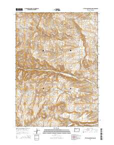
2014 Map of Little Juniper Spring
USGS Topo · Published 2014About this map
Little Juniper Spring and Coyote Spring serve as critical water sources in this arid stretch of eastern Oregon, where the landscape is defined by the drainage systems of Bully Cr and N Fork Indian Cr. The terrain is marked by significant topographical features such as Baker City Canyon and Stoney Gulch, illustrating the erosive power of seasonal water flow through the high desert. Settlement and land use are evidenced by a network of ranching roads, including Bendire Rd and Washington Flat Rd, which connect isolated water management points. Several small-scale catchments like Rock Cr Reservoir and Jordan Reservoir indicate a reliance on coordinated water storage to support livestock and land management in the expansive t17s r39e and t18s r39e townships.
Find a feature on this map
23 named features on this map. Tap any name to fly to it.
Don’t see what you’re looking for? This feature index may not catch every label — zoom into the map to look around manually.
Map Details
Editions of this 2014 Little Juniper Spring Map
This is the sole edition of this map. No revisions or reprints were ever made.
Other maps of this area

1908 · Ironside Mountain
USGS Topo · 1:125,000

1955 · Baker
USGS Topo · 1:250,000

1955 · Burns
USGS Topo · 1:250,000

1955 · Canyon City
USGS Topo · 1:250,000

1955 · Boise
USGS Topo · 1:250,000

1958 · Burns
USGS Topo · 1:250,000

1958 · Boise
USGS Topo · 1:250,000

1959 · Baker
USGS Topo · 1:250,000

1959 · Burns
USGS Topo · 1:250,000

1959 · Canyon City
USGS Topo · 1:250,000