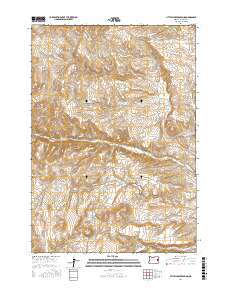
2017 Map of Little Juniper Spring
USGS Topo · Published 2017About this map
Little Juniper Spring and Coyote Spring anchor this high-desert reach of Malheur County, where a sophisticated network of water management features defines the landscape. The geography is characterized by several man-made impoundments, including Jenkins Reservoir Number One, Rock Cr Reservoir, and Hanna Reservoir, reflecting the critical importance of water storage in this arid region. These reservoirs are situated along the drainage systems of N Fork Bully Cr and Bully Cr, which wind through the township and range divisions of the high plateau.
Find a feature on this map
24 named features on this map. Tap any name to fly to it.
Don’t see what you’re looking for? This feature index may not catch every label — zoom into the map to look around manually.
Map Details
Editions of this 2017 Little Juniper Spring Map
This is the sole edition of this map. No revisions or reprints were ever made.
Other maps of this area

1908 · Ironside Mountain
USGS Topo · 1:125,000

1955 · Baker
USGS Topo · 1:250,000

1955 · Burns
USGS Topo · 1:250,000

1955 · Canyon City
USGS Topo · 1:250,000

1955 · Boise
USGS Topo · 1:250,000

1958 · Burns
USGS Topo · 1:250,000

1958 · Boise
USGS Topo · 1:250,000

1959 · Baker
USGS Topo · 1:250,000

1959 · Burns
USGS Topo · 1:250,000

1959 · Canyon City
USGS Topo · 1:250,000