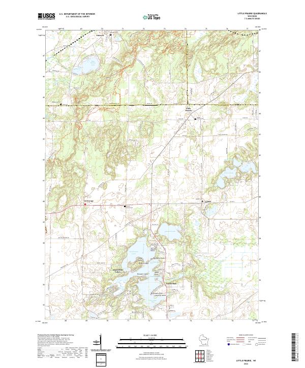
2022 Map of Little Prairie
USGS Topo · Published 2022About this map
Lauderdale Lakes dominates the southern landscape of this Walworth County survey, its intricate shoreline defined by points and bays like Tratts Point, Wolfs Point, and Stewarts Bay. The glacial geography of the Kettle Moraine is evident in the cluster of water bodies including Pleasant Lake and Blue Spring Lake, which are connected by a network of rural routes such as Kettle Moraine Dr and Territorial Rd. Local history is anchored by small crossroads communities and numerous burial grounds, including the Little Prairie Cem and Round Prairie Cem. The presence of the Ice Age National Scenic Trl cutting through the northwestern corner highlights the preservation of the area's distinct post-glacial terrain. This 2022 survey provides a clear view of the modern settlement patterns in La Grange, Adams, and Little Prairie before recent development may have altered the local character.
Find a feature on this map
76 named features on this map. Tap any name to fly to it.
Don’t see what you’re looking for? This feature index may not catch every label — zoom into the map to look around manually.
Map Details
Editions of this 2022 Little Prairie Map
This is the sole edition of this map. No revisions or reprints were ever made.
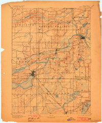
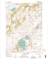
Historical Maps of Jefferson County Through Time
3 maps found