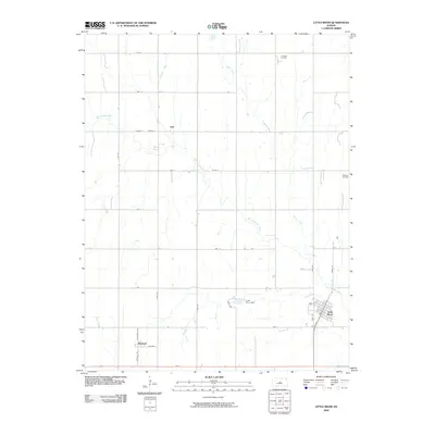
2009 Map of Little River
USGS Topo · Published 2009About this map
Little River serves as the primary population center on this central Kansas landscape, where a structured grid of rural roads meets the winding path of the Little Arkansas River. The town's layout is clearly defined by streets such as Ohio St, State St, and Main St, situated just south of the Little River Dam. To the west and north, smaller settlements like Mitchell and Galt anchor the agricultural and industrial landscape. The region’s economic character is defined by a mix of water management and energy extraction, with the Crawford Oil Field and Odessa Oil Field situated in the northern and eastern reaches of the quadrangle. Tributaries like Horse Creek and Jarvis Creek drain the surrounding fields, illustrating the essential relationship between the local hydrology and the rural road network that organizes the territory into a precise geometric pattern.
Find a feature on this map
30 named features on this map. Tap any name to fly to it.
Don’t see what you’re looking for? This feature index may not catch every label — zoom into the map to look around manually.
Map Details
Editions of this 2009 Little River Map
This is the sole edition of this map. No revisions or reprints were ever made.
Other maps of this area

1891 · Hutchinson
USGS Topo · 1:125,000

1892 · Salina
USGS Topo · 1:125,000

1893 · Hutchinson
USGS Topo · 1:125,000

1894 · Ellsworth
USGS Topo · 1:125,000

1894 · Lyons
USGS Topo · 1:125,000

1942 · Salina
USGS Topo · 1:125,000

1955 · Great Bend
USGS Topo · 1:250,000

1955 · Hutchinson
USGS Topo · 1:250,000

1957 · Great Bend
USGS Topo · 1:250,000

1958 · Great Bend
USGS Topo · 1:250,000