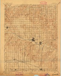
1894 Map of Ellsworth
USGS Topo · Published 1894About this map
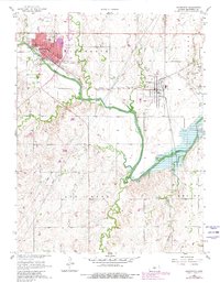
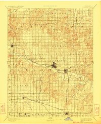
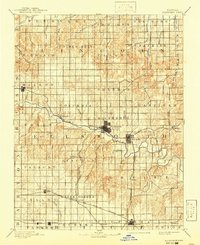
The Smoky Hill River meanders across the central plains of this 1891 survey, serving as the geographic anchor for the burgeoning railroad towns of Central Kansas. The town of Ellsworth stands as a primary hub where the Union Pacific Railway follows the river valley, connecting smaller settlements like Blackwolf and Kanopolis. To the south, the expansion of the Atchison Topeka and Santa Fe Railroad and the Missouri Pacific Railway drove the development of farming communities such as Holyrood, Lorraine, and Geneseo. The map illustrates a landscape transitioning from open prairie into a highly organized grid of townships, including Palacky, Green Garden, and Columbia. Notable natural landmarks like Table Rock and the northern Saline River provide a contrast to the geometric precision of the newly established rail lines and cattle country infrastructure.
Find a feature on this map
62 named features on this map. Tap any name to fly to it.
Don’t see what you’re looking for? This feature index may not catch every label — zoom into the map to look around manually.
Map Details
Editions of this 1894 Ellsworth Map
4 editions found
Historical Maps of Ellsworth Through Time
7 maps found