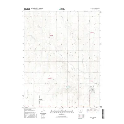
2015 Map of Little River
USGS Topo · Published 2015About this map
Little River anchors the southeastern corner of this Rice County survey, where a tight grid of streets including Main St and State St meet near the banks of the Little Arkansas River. The landscape is defined by the winding paths of seasonal waterways and the rigid section-line road network typical of the Kansas plains. North and west of the primary settlement, the small communities of Galt and Mitchell represent the quiet rural centers of the early 21st century. The terrain is marked by gentle drainage basins for Horse Cr and Jarvis Cr, which flow toward the river valley. The presence of Spriggs Rock Lake provides a localized landmark in a region dominated by agricultural tracts and surveyed townships such as t19s r6w.
Find a feature on this map
37 named features on this map. Tap any name to fly to it.
Don’t see what you’re looking for? This feature index may not catch every label — zoom into the map to look around manually.
Map Details
Editions of this 2015 Little River Map
This is the sole edition of this map. No revisions or reprints were ever made.
Other maps of this area

1891 · Hutchinson
USGS Topo · 1:125,000

1892 · Salina
USGS Topo · 1:125,000

1893 · Hutchinson
USGS Topo · 1:125,000

1894 · Ellsworth
USGS Topo · 1:125,000

1894 · Lyons
USGS Topo · 1:125,000

1942 · Salina
USGS Topo · 1:125,000

1955 · Great Bend
USGS Topo · 1:250,000

1955 · Hutchinson
USGS Topo · 1:250,000

1957 · Great Bend
USGS Topo · 1:250,000

1958 · Great Bend
USGS Topo · 1:250,000