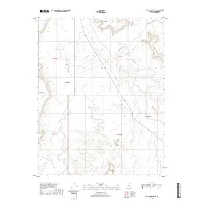
2018 Map of Little Round Rock
USGS Topo · Published 2018About this map
Chinle Valley dominates this high-desert landscape in Apache County, defined by its complex drainage systems and dramatic rock formations. The western portion of the map is shaped by the broad expanse of Chinle Wash and the rising slopes of Carson Mesa. Several intermittent watercourses, including Lukachukai Creek, Agua Sal Wash, and Hasbidito Cr, carve through the arid terrain, converging as they move toward the central valley. Notable geologic landmarks punctuate the horizon, from the distinct peak of Little Round Rock to the larger Round Rock formation in the south and the Rock Window in the north. This modern survey illustrates the persistent transportation network within the Navajo Nation, anchored by Indian Rte 8008 and Indian Rte 8009, which provide essential access across this remote section of the Colorado Plateau.
Find a feature on this map
16 named features on this map. Tap any name to fly to it.
Don’t see what you’re looking for? This feature index may not catch every label — zoom into the map to look around manually.
Map Details
Editions of this 2018 Little Round Rock Map
This is the sole edition of this map. No revisions or reprints were ever made.
Other maps of this area

1892 · Canyon De Chelly
USGS Topo · 1:250,000

1953 · Los Gigantes NW
USGS Topo · 1:24,000

1953 · Los Gigantes SW
USGS Topo · 1:24,000

1953 · Los Gigantes Buttes
USGS Topo · 1:62,500

1954 · Shiprock
USGS Topo · 1:250,000

1955 · Sonsala Butte 2 NW
USGS Topo · 1:24,000
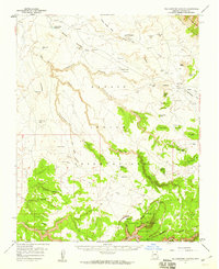
1955 · Yellowstone Canyon
USGS Topo · 1:62,500

1958 · Shiprock
USGS Topo · 1:250,000

1959 · Shiprock
USGS Topo · 1:250,000

1968 · Rock Point SW
USGS Topo · 1:24,000