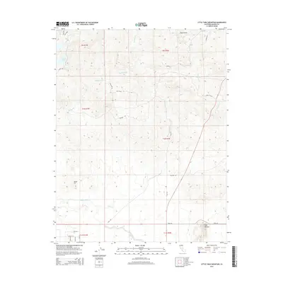
2015 Map of Little Table Mountain
USGS Topo · Published 2015About this map
Little Table Mountain and the surrounding high ground of Madera County dominate this 2015 topographic study. The landscape is defined by the critical water infrastructure of the Madera Canal and the eastern reaches of Hensley Lake, illustrating the managed hydrology of this California region. Small drainages like Hildreth Cr and Mud Spring Cr cut through the terrain, while local markers such as Adobe Hill and Happy Hollow provide focal points for the topography. The map reveals a network of rural roads, including Road 400 and Road 209, connecting scattered property lines and the foothill environment. The lack of dense municipal centers highlights the area's character as a space of open range and water management, where the elevation drops from the heights of the mountain toward the Cottonwood Cr drainage in the east.
Find a feature on this map
30 named features on this map. Tap any name to fly to it.
Don’t see what you’re looking for? This feature index may not catch every label — zoom into the map to look around manually.
Map Details
Editions of this 2015 Little Table Mountain Map
This is the sole edition of this map. No revisions or reprints were ever made.
Other maps of this area

1912 · Mariposa
USGS Topo · 1:125,000

1916 · Sulphur Springs
USGS Topo · 1:24,000

1919 · Sulphur Springs
USGS Topo · 1:31,680

1919 · Little Table Mountain
USGS Topo · 1:31,680

1921 · Daulton
USGS Topo · 1:31,680

1922 · Lanes Bridge
USGS Topo · 1:31,680

1922 · Friant
USGS Topo · 1:31,680

1922 · Gregg
USGS Topo · 1:31,680

1942 · Raymond
USGS Topo · 1:62,500

1942 · Daulton
USGS Topo · 1:24,000