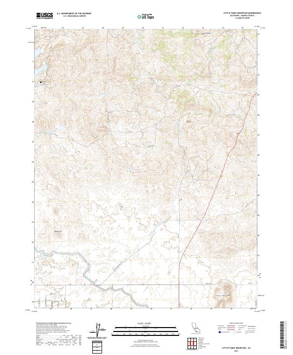
2021 Map of Little Table Mountain
USGS Topo · Published 2021About this map
Hensley Noble Ranch Cem stands as a quiet marker of early family landholdings in this pocket of the San Joaquin Valley foothills. The landscape is defined by the contrast between high topographic points like Little Table Mtn and Adobe Hill and the essential water infrastructure that supports the region's agriculture. The Madera Canal cuts through the southern portion of the quadrangle, representing the critical mid-20th-century irrigation efforts that transformed this arid terrain. Seasonal drainages such as Mud Spring Cr, Cottonwood Cr, and Hildreth Cr weave through the hills toward the valley floor, alongside a network of ranch roads including Wide Awake Ranch Rd and Oakwood Rd. The map also captures the secluded basin of Happy Hollow, illustrating the mixture of cattle ranching heritage and modern rural development.
Find a feature on this map
34 named features on this map. Tap any name to fly to it.
Don’t see what you’re looking for? This feature index may not catch every label — zoom into the map to look around manually.
Map Details
Editions of this 2021 Little Table Mountain Map
This is the sole edition of this map. No revisions or reprints were ever made.
Other maps of this area

1912 · Mariposa
USGS Topo · 1:125,000

1916 · Sulphur Springs
USGS Topo · 1:24,000

1919 · Sulphur Springs
USGS Topo · 1:31,680

1919 · Little Table Mountain
USGS Topo · 1:31,680

1921 · Daulton
USGS Topo · 1:31,680

1922 · Lanes Bridge
USGS Topo · 1:31,680

1922 · Friant
USGS Topo · 1:31,680

1922 · Gregg
USGS Topo · 1:31,680

1942 · Raymond
USGS Topo · 1:62,500

1942 · Daulton
USGS Topo · 1:24,000