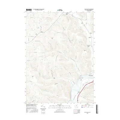
2016 Map of Little Valley
USGS Topo · Published 2016About this map
Little Valley and the northern reaches of Salamanca anchor this survey of the Allegany Plateau, where steep-sided valleys like Lees Hollow and Dublin Hollow dictate the local geography. The landscape is defined by the significant watershed of Bucktooth Run and its numerous branches, flowing south toward the Allegheny Reservoir. This 2016 edition provides a modern topographic perspective on the region's established rural infrastructure, noting the persistence of historical family and community sites such as Maple Grove Cem, Annis Cem, and Crawford Cem. Significant recreational and transit corridors are documented, including the N Country National Scenic Trail which traverses the high ground near Shutts Hill. The map also captures the distinct riverine environment near Newtons Eddy and Bucktooth Island, illustrating the complex interaction between the plateau's drainage systems and the southern valley floor.
Find a feature on this map
63 named features on this map. Tap any name to fly to it.
Don’t see what you’re looking for? This feature index may not catch every label — zoom into the map to look around manually.
Map Details
Editions of this 2016 Little Valley Map
This is the sole edition of this map. No revisions or reprints were ever made.
Other maps of this area

1900 · Salamanca
USGS Topo · 1:62,500

1922 · Randolph
USGS Topo · 1:62,500

1923 · Randolph
USGS Topo · 1:62,500

1923 · Cattaraugus
USGS Topo · 1:62,500

1924 · Ellicottville
USGS Topo · 1:62,500

1938 · Cattaraugus
USGS Topo · 1:62,500

1938 · Salamanca
USGS Topo · 1:62,500

1941 · Cattaraugus
USGS Topo · 1:62,500

1941 · Ellicottville
USGS Topo · 1:62,500

1943 · Randolph
USGS Topo · 1:62,500