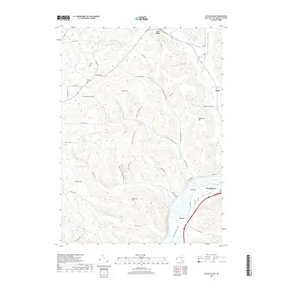
2019 Map of Little Valley
USGS Topo · Published 2019About this map
Little Valley anchors the northern extent of this landscape, where the terrain breaks into the narrow valleys of Little Valley Creek and Dublin Hollow. The topography is defined by prominent peaks like Shutts Hill and Bucktooth Hill, carved by a complex network of runs including West Branch Bucktooth Run and Sawmill Run. A portion of the North Country National Scenic Trail winds through these heights, offering a modern passage through a landscape historically shaped by small settlements like Elkdale and Shongo. To the south, the terrain descends toward the river flats of Salamanca, where Bucktooth Rapids and Newtons Eddy mark the river's path. Local heritage is preserved in sites such as Maple Grove Cemetery and Annis Cemetery, which serve as quiet markers of the families who settled this corner of Cattaraugus County.
Find a feature on this map
62 named features on this map. Tap any name to fly to it.
Don’t see what you’re looking for? This feature index may not catch every label — zoom into the map to look around manually.
Map Details
Editions of this 2019 Little Valley Map
This is the sole edition of this map. No revisions or reprints were ever made.
Other maps of this area

1900 · Salamanca
USGS Topo · 1:62,500

1922 · Randolph
USGS Topo · 1:62,500

1923 · Randolph
USGS Topo · 1:62,500

1923 · Cattaraugus
USGS Topo · 1:62,500

1924 · Ellicottville
USGS Topo · 1:62,500

1938 · Cattaraugus
USGS Topo · 1:62,500

1938 · Salamanca
USGS Topo · 1:62,500

1941 · Cattaraugus
USGS Topo · 1:62,500

1941 · Ellicottville
USGS Topo · 1:62,500

1943 · Randolph
USGS Topo · 1:62,500