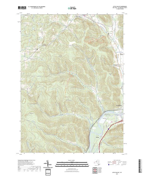
2023 Map of Little Valley
USGS Topo · Published 2023About this map
Little Valley and Salamanca anchor the northern and southern reaches of this landscape, where the waters of Little Valley Creek and the Allegheny River have shaped local settlement. The terrain is defined by prominent rises like Dutch Hill and Bucktooth Hill, cut through by numerous hollows and runs such as Dublin Hollow and Sunfish Run. This modern survey traces a complex network of multi-use pathways that have replaced older transport corridors, including the North Country National Scenic Trail, the Pat McGee Trail, and various snowmobile and horse trails. For genealogists, the map preserves the locations of Maple Grove Cem and Annis Cem, while river landmarks like Bucktooth Rapids and Newtons Eddy highlight the area's historic reliance on the Allegheny waterway. The smaller communities of Elkdale and Shongo sit amidst this wooded valley system, connected by a winding road network that skirts the base of peaks like Parker Hill and Jimmerson Hill.
Find a feature on this map
62 named features on this map. Tap any name to fly to it.
Don’t see what you’re looking for? This feature index may not catch every label — zoom into the map to look around manually.
Map Details
Editions of this 2023 Little Valley Map
This is the sole edition of this map. No revisions or reprints were ever made.
Other maps of this area

1900 · Salamanca
USGS Topo · 1:62,500

1922 · Randolph
USGS Topo · 1:62,500

1923 · Randolph
USGS Topo · 1:62,500

1923 · Cattaraugus
USGS Topo · 1:62,500

1924 · Ellicottville
USGS Topo · 1:62,500

1938 · Cattaraugus
USGS Topo · 1:62,500

1938 · Salamanca
USGS Topo · 1:62,500

1941 · Cattaraugus
USGS Topo · 1:62,500

1941 · Ellicottville
USGS Topo · 1:62,500

1943 · Randolph
USGS Topo · 1:62,500