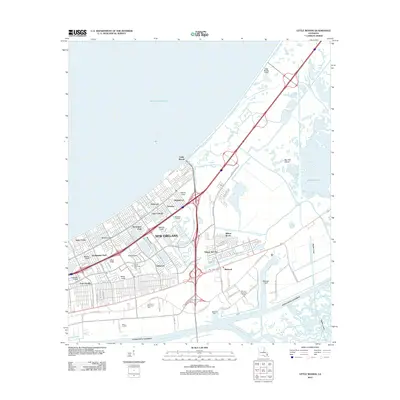
2012 Map of Little Woods
USGS Topo · Published 2012About this map
The Michoud Assembly Facility anchors this survey of eastern New Orleans, a landscape defined by its precarious relationship with water. Reclaimed marshlands are organized by an extensive network of drainage channels, including the Morrison Canal, Jahncke Canal, and Gannon Canal, which protect residential neighborhoods like Ferncrest and Tamaron. The industrial character of the region is evident in the convergence of the Intracoastal Waterway and the Mississippi River-Gulf Outlet Canal, critical arteries for the city's maritime commerce.
Find a feature on this map
88 named features on this map. Tap any name to fly to it.
Don’t see what you’re looking for? This feature index may not catch every label — zoom into the map to look around manually.
Map Details
Editions of this 2012 Little Woods Map
This is the sole edition of this map. No revisions or reprints were ever made.
Other maps of this area

1891 · Spanish Fort
USGS Topo · 1:62,500

1891 · New Orleans
USGS Topo · 1:62,500

1892 · Chef Menteur
USGS Topo · 1:62,500

1892 · St. Bernard
USGS Topo · 1:62,500

1932 · New Orleans NE
USGS Topo · 1:31,680

1936 · North Shore
USGS Topo · 1:31,680

1936 · South Point
USGS Topo · 1:31,680

1936 · Chef Menteur
USGS Topo · 1:62,500

1936 · Spanish Fort
USGS Topo · 1:62,500

1937 · Chef Menteur
USGS Topo · 1:31,680
Featured Places
- New Orleans, LA
- Michoud, New Orleans
- Kingswood, New Orleans
- Lake Carmel, New Orleans
- Ferncrest, New Orleans