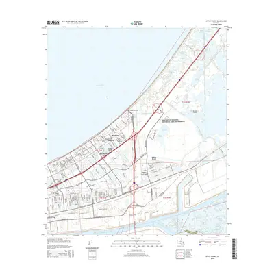
2015 Map of Little Woods
USGS Topo · Published 2015About this map
Lake Pontchartrain dominates the northern horizon of this coastal Orleans Parish landscape, where the urban grid of New Orleans East meets the sprawling wetlands of the Jean Lafitte National Historical Park and Preserve. The map illustrates a complex water management system defined by the Morrison Canal, Citrus Canal, and Dwyer Canal, which protect residential developments like Kingswood, Village de L'Est, and Lake Carmel. To the south, the industrial and maritime character of the region is evident along the Intracoastal Waterway and the Mississippi River-Gulf Outlet Canal, flanking the community of Michoud. This 2015 survey reveals the transition from dense suburban blocks to the protected marshes of Bayou Sauvage, highlighting the delicate balance between reclaimed land and the natural bayous and lagoons that still define the delta.
Find a feature on this map
63 named features on this map. Tap any name to fly to it.
Don’t see what you’re looking for? This feature index may not catch every label — zoom into the map to look around manually.
Map Details
Editions of this 2015 Little Woods Map
This is the sole edition of this map. No revisions or reprints were ever made.
Other maps of this area

1891 · Spanish Fort
USGS Topo · 1:62,500

1891 · New Orleans
USGS Topo · 1:62,500

1892 · Chef Menteur
USGS Topo · 1:62,500

1892 · St. Bernard
USGS Topo · 1:62,500

1932 · New Orleans NE
USGS Topo · 1:31,680

1936 · North Shore
USGS Topo · 1:31,680

1936 · South Point
USGS Topo · 1:31,680

1936 · Chef Menteur
USGS Topo · 1:62,500

1936 · Spanish Fort
USGS Topo · 1:62,500

1937 · Chef Menteur
USGS Topo · 1:31,680
Featured Places
- New Orleans, LA
- Michoud, New Orleans
- Kingswood, New Orleans
- Lake Carmel, New Orleans
- Ferncrest, New Orleans