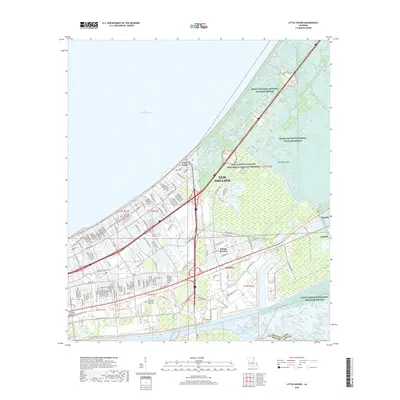
2018 Map of Little Woods
USGS Topo · Published 2018About this map
New Orleans' eastern reaches and the wetlands of Orleans Parish are defined by a complex network of industrial waterways and protected natural areas. The dense residential grids of Village de L'Est and Little Woods stand in sharp contrast to the sprawling Bayou Sauvage National Wildlife Refuge, which encompasses the eastern half of the map. Along the southern edge, the Intracoastal Waterway and Mississippi River-Gulf Outlet Canal facilitate heavy maritime traffic near Michoud. A intricate system of drainage and navigation canals, including Little Woods Canal, Morrison Canal, and Dwyer Canal, underscores the engineering required to maintain these neighborhoods between Lake Pontchartrain and the surrounding marshlands. Local landmarks like Resthaven Memorial Park Cem and Big Oak Island provide grounding points for genealogists and local historians studying the mid-to-late 20th-century development of this coastal landscape.
Find a feature on this map
52 named features on this map. Tap any name to fly to it.
Don’t see what you’re looking for? This feature index may not catch every label — zoom into the map to look around manually.
Map Details
Editions of this 2018 Little Woods Map
This is the sole edition of this map. No revisions or reprints were ever made.
Other maps of this area

1891 · Spanish Fort
USGS Topo · 1:62,500

1891 · New Orleans
USGS Topo · 1:62,500

1892 · Chef Menteur
USGS Topo · 1:62,500

1892 · St. Bernard
USGS Topo · 1:62,500

1932 · New Orleans NE
USGS Topo · 1:31,680

1936 · North Shore
USGS Topo · 1:31,680

1936 · South Point
USGS Topo · 1:31,680

1936 · Chef Menteur
USGS Topo · 1:62,500

1936 · Spanish Fort
USGS Topo · 1:62,500

1937 · Chef Menteur
USGS Topo · 1:31,680
Featured Places
- New Orleans, LA
- Michoud, New Orleans
- Kingswood, New Orleans
- Lake Carmel, New Orleans
- Ferncrest, New Orleans