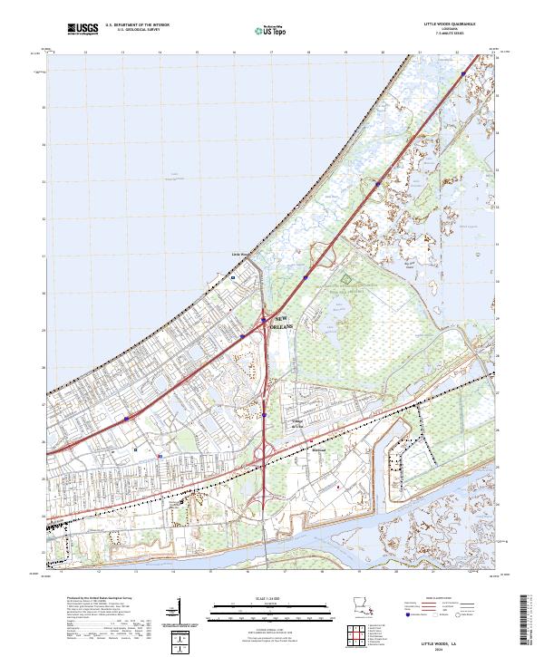
2024 Map of Little Woods
USGS Topo · Published 2024About this map
The coastal wetlands and industrial corridors of eastern New Orleans are defined here by a dense network of canals and protected marshlands. Bordering Lake Pontchartrain, the landscape transitions from the residential street grids of Village de L'Est and Little Woods into the vast expanse of the Bayou Sauvage National Wildlife Refuge. The map illustrates the complex water management system of the region, featuring numerous drainage and transport channels such as the Little Woods Canal, Dwyer Canal, and the Michoud Canal.
Find a feature on this map
60 named features on this map. Tap any name to fly to it.
Don’t see what you’re looking for? This feature index may not catch every label — zoom into the map to look around manually.
Map Details
Editions of this 2024 Little Woods Map
This is the sole edition of this map. No revisions or reprints were ever made.
Other maps of this area

1891 · Spanish Fort
USGS Topo · 1:62,500

1891 · New Orleans
USGS Topo · 1:62,500

1892 · Chef Menteur
USGS Topo · 1:62,500

1892 · St. Bernard
USGS Topo · 1:62,500

1932 · New Orleans NE
USGS Topo · 1:31,680

1936 · North Shore
USGS Topo · 1:31,680

1936 · South Point
USGS Topo · 1:31,680

1936 · Chef Menteur
USGS Topo · 1:62,500

1936 · Spanish Fort
USGS Topo · 1:62,500

1937 · Chef Menteur
USGS Topo · 1:31,680
Featured Places
- New Orleans, LA
- Kingswood, New Orleans
- Lake Carmel, New Orleans
- Willow Brook, New Orleans
- Ferncrest, New Orleans