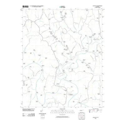
2010 Map of Littlelot
USGS Topo · Published 2010About this map
The winding course of the Duck River and Lick Creek dominates this Hickman County landscape, where the terrain is marked by an extensive history of resource extraction. Industry is visible through the Tottys Bend Mines, Worley Mine, and the M C West Tailings Pond Dam near Anderson Bend Mine. This rural topography is etched with numerous family and community landmarks, including the McFarland Cemetery, Darden Cemetery, and Harvill Cemetery, providing essential data for genealogical research in the Tennessee backcountry.
Find a feature on this map
172 named features on this map. Tap any name to fly to it.
Don’t see what you’re looking for? This feature index may not catch every label — zoom into the map to look around manually.
Map Details
Editions of this 2010 Littlelot Map
This is the sole edition of this map. No revisions or reprints were ever made.
Other maps of this area

1901 · Colombia
USGS Topo · 1:125,000

1936 · Williamsport
USGS Topo · 1:24,000

1936 · Primm
USGS Topo · 1:24,000

1936 · Nunnelly
USGS Topo · 1:24,000

1936 · Sunrise
USGS Topo · 1:24,000

1936 · Littlelot
USGS Topo · 1:24,000

1936 · Texas Hollow
USGS Topo · 1:24,000

1936 · Greenfield Bend
USGS Topo · 1:24,000

1936 · Craigfield
USGS Topo · 1:24,000

1936 · Lyles
USGS Topo · 1:24,000