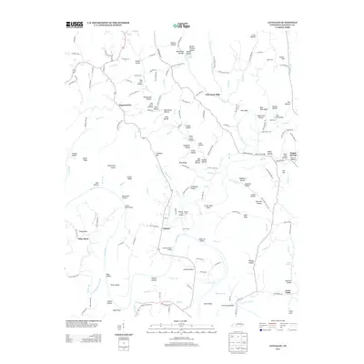
2013 Map of Littlelot
USGS Topo · Published 2013About this map
The Duck River winds through this section of Hickman County, creating a landscape of deep bends and fertile bottomlands such as Anderson Bend and Smith Bend. The settlement of Littlelot serves as a central point in a region defined by its numerous hollows and ridges, including Sugarcamp Hollow and Blue Hole Bluff. The presence of Little Rock Mills suggests the historical importance of water-powered industry along the local creeks, while the name Primm Springs points to the area's geological character on the eastern edge of the quadrangle.
Find a feature on this map
174 named features on this map. Tap any name to fly to it.
Don’t see what you’re looking for? This feature index may not catch every label — zoom into the map to look around manually.
Map Details
Editions of this 2013 Littlelot Map
This is the sole edition of this map. No revisions or reprints were ever made.
Other maps of this area

1901 · Colombia
USGS Topo · 1:125,000

1936 · Williamsport
USGS Topo · 1:24,000

1936 · Primm
USGS Topo · 1:24,000

1936 · Nunnelly
USGS Topo · 1:24,000

1936 · Sunrise
USGS Topo · 1:24,000

1936 · Littlelot
USGS Topo · 1:24,000

1936 · Texas Hollow
USGS Topo · 1:24,000

1936 · Greenfield Bend
USGS Topo · 1:24,000

1936 · Craigfield
USGS Topo · 1:24,000

1936 · Lyles
USGS Topo · 1:24,000