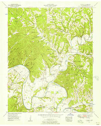
1952 Map of Littlelot
USGS Topo · Published 1957About this map
The Duck River winds through this rural landscape in the early 1950s, creating sharp meanders like Totty Bend and Anderson Bend. The settlement of Littlelot serves as a central point in a region defined by its reliance on the river and its numerous creek systems, including Lick Creek. Transportation during this era still utilized historic crossing points such as the Leatherwood Ferry and the Bratton Ford Bridge, reflecting a time before modern infrastructure fully bypassed the older river-and-road network.
Find a feature on this map
141 named features on this map. Tap any name to fly to it.
Don’t see what you’re looking for? This feature index may not catch every label — zoom into the map to look around manually.
Map Details
Editions of this 1952 Littlelot Map
2 editions found
Other maps of this area

1901 · Colombia
USGS Topo · 1:125,000

1936 · Williamsport
USGS Topo · 1:24,000

1936 · Primm
USGS Topo · 1:24,000

1936 · Nunnelly
USGS Topo · 1:24,000

1936 · Sunrise
USGS Topo · 1:24,000

1936 · Littlelot
USGS Topo · 1:24,000

1936 · Texas Hollow
USGS Topo · 1:24,000

1936 · Greenfield Bend
USGS Topo · 1:24,000

1936 · Craigfield
USGS Topo · 1:24,000

1936 · Lyles
USGS Topo · 1:24,000