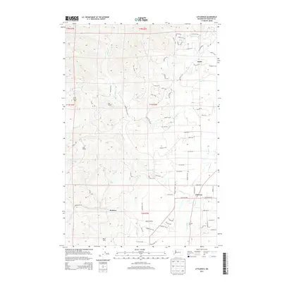
2013 Map of Littlerock
USGS Topo · Published 2013About this map
The Black Hills dominate the western half of this 2013 quadrangle, creating a high-elevation backdrop for the agricultural and residential valleys of Thurston County. Centered near Littlerock, the landscape transitions from the steep, forested slopes of Little Larch Mtn and Mt Molly into the unique glacial topography of the Mima Prairie. This area is famously defined by its undulating mound formations, visible here near Mima Falls.
Find a feature on this map
101 named features on this map. Tap any name to fly to it.
Don’t see what you’re looking for? This feature index may not catch every label — zoom into the map to look around manually.
Map Details
Editions of this 2013 Littlerock Map
This is the sole edition of this map. No revisions or reprints were ever made.
Other maps of this area

1916 · Chehalis
USGS Topo · 1:125,000

1937 · Olympia
USGS Topo · 1:62,500

1939 · Shelton
USGS Topo · 1:62,500

1940 · Tenino
USGS Topo · 1:62,500

1941 · Gate
USGS Topo · 1:62,500

1944 · Tenino
USGS Topo · 1:62,500

1949 · Tenino
USGS Topo · 1:62,500

1949 · Olympia
USGS Topo · 1:62,500

1953 · Hoquiam
USGS Topo · 1:250,000

1953 · Rochester
USGS Topo · 1:62,500