
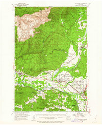
1953 Map of Rochester
USGS Topo · Published 1955About this map
The Chehalis Indian Reservation occupies the fertile lowlands where the Black River meets the Chehalis River, a landscape defined by its river-bottom agriculture and intricate rail network in the early 1950s. This survey captures a moment when the regional economy was heavily reliant on both timber and transit, evidenced by the extensive Capitol State Forest to the north and the converging lines of the Northern Pacific, Union Pacific, and the Milwaukee Road. Local history is deeply embedded in labels like the Fort Henness Site and the State Sch for Girls near Grand Mound. From the timber town of Bordeaux to the farming community at Michigan Hill, the map details a transition from the high peaks of Capitol Peak and Larch Mtn down to the open expanses of Baker Prairie and Grand Mound Prairie.
Find a feature on this map
64 named features on this map. Tap any name to fly to it.
Don’t see what you’re looking for? This feature index may not catch every label — zoom into the map to look around manually.
Map Details
Editions of this 1953 Rochester Map
3 editions found
Other maps of this area

1916 · Chehalis
USGS Topo · 1:125,000

1937 · Olympia
USGS Topo · 1:62,500

1939 · Shelton
USGS Topo · 1:62,500

1940 · Tenino
USGS Topo · 1:62,500

1941 · Walville
USGS Topo · 1:62,500

1941 · Meskill
USGS Topo · 1:62,500

1941 · Gate
USGS Topo · 1:62,500

1941 · Ford
USGS Topo · 1:62,500

1943 · Nahwatzel Lake
USGS Topo · 1:62,500

1944 · Tenino
USGS Topo · 1:62,500