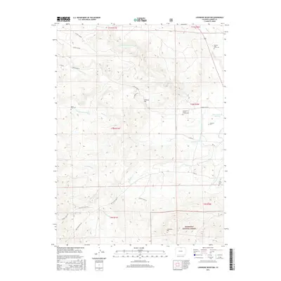
2016 Map of Livermore Mountain
USGS Topo · Published 2016About this map
The N Fork Cache La Poudre River winds through this section of Larimer County, where ranching history and early transportation routes have left a permanent mark on the landscape. Several small burial grounds, including the Cherokee Stage Station Cem and Elliott Ranch Cem, point to the era of stagecoach travel and homesteading along the river forks. A solitary memorial, the Christopher Charles Cradock Grave, sits isolated near N Poudre Canal, offering a poignant look at individual pioneer history in the region.
Find a feature on this map
37 named features on this map. Tap any name to fly to it.
Don’t see what you’re looking for? This feature index may not catch every label — zoom into the map to look around manually.
Map Details
Editions of this 2016 Livermore Mountain Map
This is the sole edition of this map. No revisions or reprints were ever made.
Other maps of this area

1906 · Fort Collins
USGS Topo · 1:62,500

1907 · Livermore
USGS Topo · 1:125,000

1908 · Fort Collins
USGS Topo · 1:62,500

1909 · Livermore
USGS Topo · 1:125,000

1954 · Greeley
USGS Topo · 1:250,000

1957 · Greeley
USGS Topo · 1:250,000

1958 · Greeley
USGS Topo · 1:250,000

1960 · Livermore
USGS Topo · 1:24,000

1960 · Haystack Gulch
USGS Topo · 1:24,000

1960 · Livermore Mountain
USGS Topo · 1:24,000