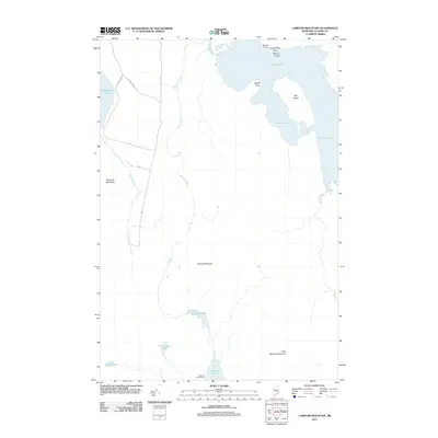
2011 Map of Lobster Mountain
USGS Topo · Published 2011About this map
Lobster Lake dominates the northeast corner of this Maine wilderness landscape, characterized by its irregular shoreline and islands including Big Island and Marion Island. The area is a nexus of North Woods hydrography, where the lake connects to Lobster Stream and is surrounded by numerous smaller water bodies such as Little Spencer Pond, Tom Young Pond, and Little Duck Pond. The terrain is defined by isolated peaks including Lobster Mountain, Norcross Mountain, and Little Spencer Mountain, which rise above a network of logging roads and brooks.
Find a feature on this map
24 named features on this map. Tap any name to fly to it.
Don’t see what you’re looking for? This feature index may not catch every label — zoom into the map to look around manually.
Map Details
Editions of this 2011 Lobster Mountain Map
This is the sole edition of this map. No revisions or reprints were ever made.
Other maps of this area

1920 · Moosehead Lake
USGS Topo · 1:62,500

1922 · Moosehead Lake
USGS Topo · 1:62,500

1930 · Moosehead Lake
USGS Topo · 1:62,500

1944 · Moosehead Lake
USGS Topo · 1:62,500

1952 · First Roach Pond
USGS Topo · 1:62,500

1954 · North East Carry
USGS Topo · 1:62,500

1954 · Grant Farm
USGS Topo · 1:62,500

1954 · Millinocket
USGS Topo · 1:250,000

1957 · Moosehead Lake
USGS Topo · 1:62,500

1958 · Millinocket
USGS Topo · 1:250,000
Featured Places
- Northeast Carry Township, ME
- TX R14 WELS, ME
- East Middlesex Canal Grant Township, ME
- Lobster Township, ME
- Piscataquis County, ME