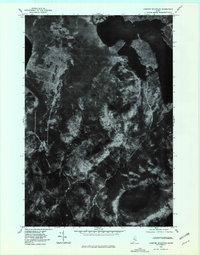
1977 Map of Lobster Mountain
USGS Topo · Published 1981About this map
Lobster Lake dominates the northern reaches of this orthophotoquad, its irregular shoreline and surrounding wetlands providing a clear view of the Piscataquis County wilderness in the late 1970s. The aerial imagery captures the dense forest canopy of the North Maine Woods, punctuated by significant elevations like Lobster Mountain and Norcross Mountain. This type of survey, relying on a 1977 aerial photograph, reveals the land as a working timberland, where logging roads and clearings contrast with the dark, undisturbed water of Spencer Pond and the drainage of Lobster Stream. Toward the east, the map captures a portion of Moosehead Lake, providing a precise record of the shoreline and hydrology before later development or shifts in forest management altered the local landscape.
Find a feature on this map
8 named features on this map. Tap any name to fly to it.
Don’t see what you’re looking for? This feature index may not catch every label — zoom into the map to look around manually.
Map Details
Editions of this 1977 Lobster Mountain Map
This is the sole edition of this map. No revisions or reprints were ever made.
Other maps of this area

1920 · Moosehead Lake
USGS Topo · 1:62,500

1922 · Moosehead Lake
USGS Topo · 1:62,500

1930 · Moosehead Lake
USGS Topo · 1:62,500

1944 · Moosehead Lake
USGS Topo · 1:62,500

1952 · First Roach Pond
USGS Topo · 1:62,500

1954 · North East Carry
USGS Topo · 1:62,500

1954 · Grant Farm
USGS Topo · 1:62,500

1954 · Millinocket
USGS Topo · 1:250,000

1957 · Moosehead Lake
USGS Topo · 1:62,500

1958 · Millinocket
USGS Topo · 1:250,000
Featured Places
- Northeast Carry Township, ME
- East Middlesex Canal Grant Township, ME
- Lobster Township, ME
- TX R14 WELS, ME
- Piscataquis County, ME