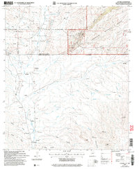
2004 Map of Lochiel
USGS Topo · Published 2007About this map
San Rafael Valley straddles the international boundary between the United States and Mexico, anchoring a landscape where ranching history meets protected wilderness. The border settlement of Lochiel serves as a primary reference point in this high-desert basin, which includes the historical La Zanja Grant and the San Rafael State Park. The map documents a network of seasonal watercourses like the Santa Cruz River and Arroyo Zorilla, which have shaped the settlement patterns of this arid region for generations.
Find a feature on this map
49 named features on this map. Tap any name to fly to it.
Don’t see what you’re looking for? This feature index may not catch every label — zoom into the map to look around manually.
Map Details
Editions of this 2004 Lochiel Map
This is the sole edition of this map. No revisions or reprints were ever made.
Other maps of this area

1905 · Nogales
USGS Topo · 1:125,000

1914 · Hereford
USGS Topo · 1:125,000

1922 · Sunnyside
USGS Topo · 1:62,500

1932 · Lochiel
USGS Topo · 1:62,500

1938 · Sunnyside
USGS Topo · 1:62,500

1948 · Canelo Pass
USGS Topo · 1:24,000

1948 · Huachuca Peak
USGS Topo · 1:24,000
1948 · Sunnyside SW
USGS Topo · 1:24,000
1948 · Lochiel SE
USGS Topo · 1:24,000

1948 · Harshaw
USGS Topo · 1:24,000