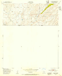
1948 Map of Lochiel SE
USGS Topo · Published 1953About this map
Lochiel sits directly against the international border in this mid-century study of the Arizona-Mexico frontier. The settlement is anchored by the U. S. Custom House, serving as a critical port of entry during a period when this ranching landscape remained largely defined by the open range of the San Rafael de la Zanja land grant. The Santa Cruz River cuts across the western portion of the sheet, providing a vital water source for the numerous Windmills that dot the high-desert terrain. To the east, the boundary of the Coronado National Forest rises into more broken country, where deep drainages like Parker Canyon and Adams Canyon define the topography. The presence of the Jones Ranch suggests the enduring cattle-ranching legacy of Santa Cruz County, where remote homesteads and government outposts existed in isolation long after the initial frontier era.
Find a feature on this map
16 named features on this map. Tap any name to fly to it.
Don’t see what you’re looking for? This feature index may not catch every label — zoom into the map to look around manually.
Map Details
Editions of this 1948 Lochiel SE Map
This is the sole edition of this map. No revisions or reprints were ever made.
Other maps of this area

1905 · Nogales
USGS Topo · 1:125,000

1914 · Hereford
USGS Topo · 1:125,000

1922 · Sunnyside
USGS Topo · 1:62,500

1932 · Lochiel
USGS Topo · 1:62,500

1938 · Sunnyside
USGS Topo · 1:62,500

1948 · Canelo Pass
USGS Topo · 1:24,000

1948 · Huachuca Peak
USGS Topo · 1:24,000
1948 · Sunnyside SW
USGS Topo · 1:24,000

1948 · Harshaw
USGS Topo · 1:24,000
1948 · Duquesne
USGS Topo · 1:24,000